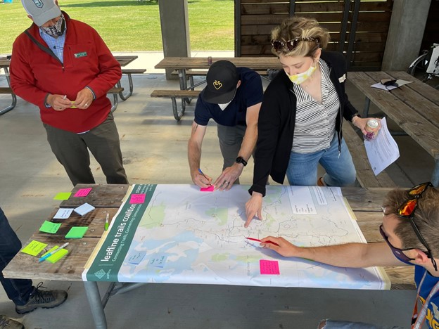

Earlier this month the Leafline Trails Coalition shared their vision to connect Central Puget Sound through over 900 miles of trails. Parametrix employee-owner Hailey Brey has volunteered her time and technical skills over the last year and a half to create a WebMap of the trails.
The Leafline Trails Coalition is made up of more than 60 organizations, agencies, and businesses. Their vision is for an “interconnected, intuitive, well-traveled, and treasured network of trails spanning the Central Puget Sound region, providing equitable access, health benefits, and recreational opportunities for all.”
In February 2021, Leafline Trails Coalition put out a call for GIS-savvy volunteers. Personally and professionally, I live by the ethos that access to mobility options is a fundamental human right. Mapping is my favorite tangible tool that supports this mission, so I responded to the call, but I had no idea what a wild ride we were in for!
The process began with a typical data request to the Counties to identify our starting point. It was at this point that our team determined a need for common definitions. Many lunch-hours were spent negotiating and collaborating with various jurisdictions and Coalition members. All parties worked to agree on universal definitions that everyone was comfortable with. While trail types were being defined against Leafline’s criteria, the data was passed back and forth and went through countless iterations. Every segment was reviewed with a fine-tooth comb. Over the course of the year, I reserved Sunday afternoons for Leafline’s technical mapping work.
On June 1, the WebMap was officially released to the public. The Leafline Trails WebMap currently displays existing and planned trails. You can use the “Near Me” tool to explore segments that are accessible from your current location. The WebMap is considered a living document – check back from time to time to see new features!

As a team, we learned so much through the process. For me, it was another lesson in the power of maps – people love them, and despite maps being some of human-history’s most important documents, people are quick to forget how critical they are. While I am in the thick of it, even I tend to forget. When the product is presented at various stages and I get to see how maps almost instantly ignite inspiration within people – those moments are always magic. Additionally, I moved to Seattle in January 2020, so this has been a great way to learn geographical and political nuances that would otherwise have taken years of living and working in the region to absorb! I also learned a lot about myself and my leadership style – this work provided lots of opportunities for both professional and personal growth.
Since we’ve successfully launched our Map Vision, I am looking forward to spending more time on the trails and using our map to extend the length of my daily errands and weekend adventures by pairing my trips with both transit and trails together. At risk of being too candid, I will keep a particularly close eye on the status of Eastrail, the planned routes near Woodinville’s wineries.
I think this Map Launch orients us on right path in rectifying some antiquated perceptions. Historically, we have not prioritized trails in the same way that we are beginning to prioritize transit. Trails have been overlooked even though they offer some of the same societal benefits while requiring a smaller footprint. They offer a climate friendly mode of transportation whether you are waking, biking or rolling, provide economic benefits for nearby businesses, and they contribute to the physical and mental health of our community. We are at a moment in time where our communities are reevaluating nearly every aspect of our geographical identities, including why, when, and how we travel. I am certain that our work is boosting the Puget’s Sound trail networks into the spotlight at just the perfect time!


