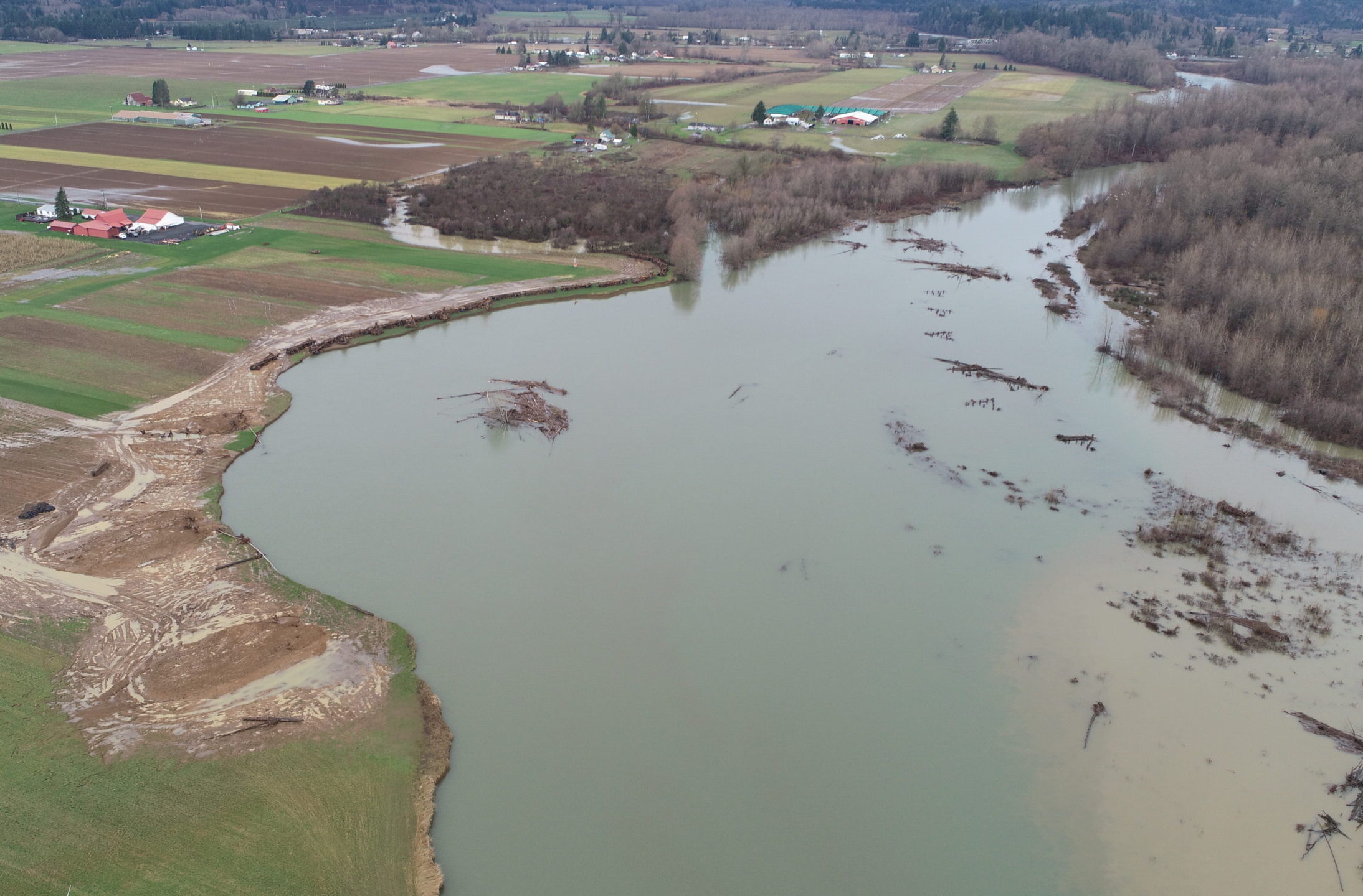
This emergency project was necessary to slow very rapid erosion of the right bank of the Lower Satsop River, which was destroying high-quality farmland and threatening a home. While a long-term program of erosion and habitat improvements is underway on the Lower Satsop, an immediate solution was needed prior to the 2021/2022 flood season. The river was eroding the bank at 10 or more feet per day under certain flow conditions, washing away acres of irreplaceable farmland and creating large quantities of fine suspended sediment that is harmful to fish.
In just four and a half months, Parametrix and teaming partner Northwest Hydraulic Consultants (NHC) worked with the client, landowners, permitting agencies, and other stakeholders to complete a feasibility study, detailed design, extensive permitting, and public outreach. The rapid timeline didn’t allow for permitting in-water work, so the team developed an unconventional solution. Crews constructed self-deploying, boulder-ballasted log structures and buried spurs upland of ordinary high water. As the high bank eroded, the structures deployed into the river, diverting flow from the eroding bank, roughening the channel, and recruiting in-stream wood and sediment to help protect the bank from further erosion. Due to rapid bank erosion and overbank flooding during construction, NHC and Parametrix performed adaptive design throughout construction, ultimately issuing eight plan revisions to keep up with the changing site. Parametrix and NHC provided on-site observation and collaboration with the contractor to successfully deliver this very dynamic project. Construction was completed in approximately 4 months, including a month of delays due to weather and flooding. Structures began deploying into the river during construction, and the river continues to engage the project with promising results.