By Chris Bourgeois
Groundwater Awareness Week is an annual observance that was started in 1999 by the National Groundwater Association (NGWA) to highlight the responsible development, management, and use of groundwater, in addition to the importance of performing annual maintenance to groundwater systems.
This week underscores the value of hydrogeologic assessments in addressing how changes in land use and infrastructure may affect aquifers. As groundwater considerations continue to intersect with infrastructure, land use, and environmental review, early coordination can help identify constraints, clarify regulatory expectations, and reduce uncertainty during permitting.
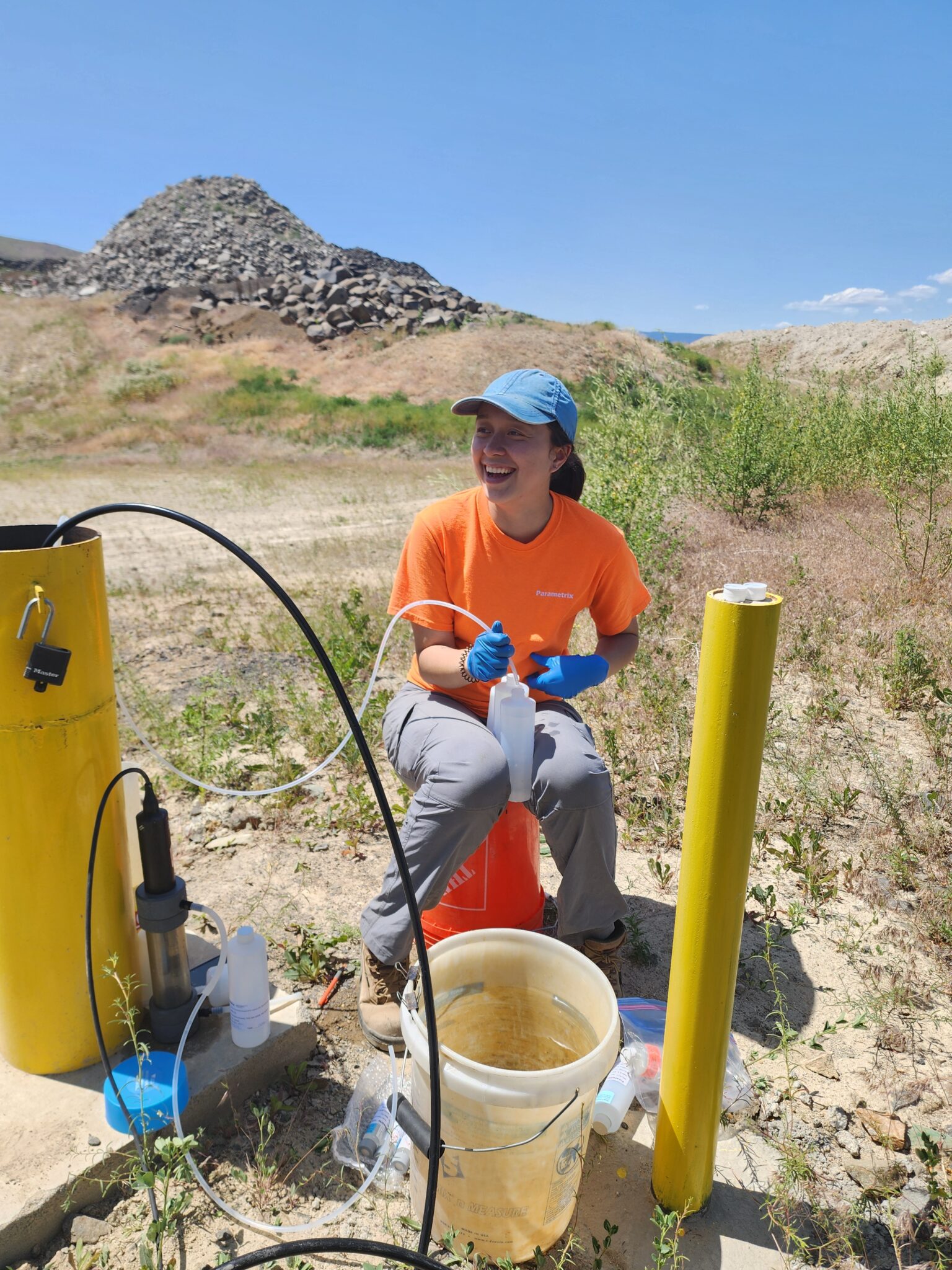
At Parametrix, our hydrogeologists support groundwater protection, often in the form of hydrogeologic assessments related to infrastructure projects.
Why is groundwater important?
According to NGWA, more than 44% of the population depends on groundwater as a primary water source, making long-term groundwater quality and availability essential to responsible land use and infrastructure planning.
For many projects, groundwater may not be the primary focus, but it can become a critical piece of the environmental and regulatory framework. Changes in land use, infrastructure, and surface water management can influence groundwater levels, movement, and quality.
Even if a project does not directly involve groundwater, it may still affect aquifers, surface water, recharge, or drinking water resources. As a result, hydrogeologic assessment is often incorporated into regulatory review for new or revised land use.
What is a hydrogeologic assessment?
Hydrogeologic assessments evaluate potential impacts to groundwater and support regulatory frameworks designed to protect groundwater resources. As a technical management tool, they help clarify how proposed activities may influence groundwater recharge and water quality.
The process includes reviewing the proposed activity and compiling available subsurface information to characterize aquifer conditions and groundwater flow. Nearby wells, surface waters, and mapped recharge or protection areas are identified and considered. Potential changes in groundwater levels or quality associated with the proposed activity are evaluated.
The findings inform regulatory review and help guide design measures or monitoring where needed.
What does a hydrogeologic review typically include?
The scope of a hydrogeologic review depends on the project and the sensitivity of the groundwater resource. The review may include:
- Review of mapped critical aquifer recharge areas (CARAs), wellhead protection areas (WHPAs), and other regulatory overlays
- Review of published geologic maps, soil maps, and hydrogeologic reports
- Identification of nearby drinking water wells, surface waters, and water rights
- Evaluation of groundwater flow direction and seasonal water level fluctuations
- Estimation of potential migration pathways and time of travel from the project site to wells or surface waters
- Assessment of aquifer vulnerability and recharge characteristics
- Evaluation of stormwater infiltration feasibility and potential groundwater mounding
- Compilation of existing surface water and groundwater quality data
- Analysis of potential impacts to groundwater and surface water quality
- Support for SEPA documentation and agency coordination
- Installation of monitoring wells, groundwater sampling, or aquifer testing, as needed
In some cases, a desktop review of mapped CARAs, WHPAs, and nearby wells is sufficient to determine applicable standards. In others, more detailed technical analysis or field investigation is required.
Hydrogeologic assessments are submitted to regulatory agencies to demonstrate compliance and, where applicable, to inform permit conditions for proposed land uses.
When are hydrogeologic reviews needed?
Hydrogeologic assessments are increasingly integrated into projects and have become a routine component of project permitting and environmental review related to:
- Stormwater and infiltration systems
- Transportation and roadway improvements
- Underground utilities and trenchless crossings
- Solid waste and materials management facilities
- Resource extraction and mineral operations
- Large-scale land development within mapped aquifer recharge areas
- Environmental review under SEPA, NEPA, and local permitting frameworks
In many cases, hydrogeologic input does not change the direction of a project, but it can help ensure that groundwater resources are investigated and protected appropriately as part of the overall design and review process.
About the Author

Chris Bourgeois
Chris Bourgeois is a Hydrogeologist at Parametrix. He has conducted and supported a variety of environmental and hydrogeologic assessments for public and private landfills, as well as other public works utility and infrastructure projects.