Projects

Cascadia High-Speed Rail and I-5 Program

Cascadia High-Speed Rail and I-5 Program

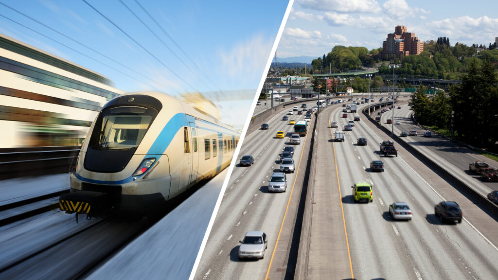
The Cascadia High-Speed Rail and I-5 Program integrates high-speed rail and I-5 system planning to address future growth and transportation needs across the Cascadia Megaregion, stretching from Portland, Oregon to Vancouver, British Columbia. The program coordinates with airports, regional transit, and Amtrak Cascades to ensure reliable movement of people and goods. It comprises two major initiatives: the Cascadia High-Speed Rail project, which aims to connect major cities with trains reaching 250 mph, and the I-5 Master Plan, focused on developing a multimodal corridor plan with prioritized improvements for the coming decades. Parametrix and HDR Engineering lead planning and support services.

Cascadia High-Speed Rail and I-5 Program Read More »

People overlook a sunset

Central Oregon Energy Resilience Plan

The Central Oregon Energy Resilience Plan was developed to strengthen the region’s capacity to anticipate, withstand, and recover from power outages while safeguarding critical services and community health. This initiative is a collaborative effort among the Central Oregon Intergovernmental Council and Crook, Deschutes, and Jefferson counties. With technical leadership from Parametrix and funding from the Oregon Department of Energy, the team assessed energy vulnerabilities and mapped essential infrastructure. The plan recommends both immediate, low-cost solutions and a long-term shift toward renewable energy systems and microgrids, ensuring sustained public safety and resilient communities as the region grows.

Central Oregon Energy Resilience Plan Read More »

Aerial of Wenatchee Valley

Wenatchee Comprehensive Greenhouse Gas Inventory

The City of Wenatchee, Washington, in collaboration with Sustainable North Central Washington, completed its first comprehensive GHG inventory using global and state guidelines. Led by Parametrix, the project collected local and consumption-based emissions data, conducted calculations, and established a detailed audit trail. The results informed a baseline report and a strategic roadmap, including input from city, utility, and community stakeholders. This inventory created Wenatchee’s first quantitative emissions baseline, shaping a strategic plan that targets impactful, cost-effective GHG reduction strategies in areas like building electrification and energy efficiency.

Wenatchee Comprehensive Greenhouse Gas Inventory Read More »

An intersection with cars exiting a freeway

I-280 Northbound Ramp/Geneva Avenue Safety Study

The I-280 Northbound Ramp/Geneva Avenue Safety Study examined ways to improve multimodal safety and address backups at the I-280 northbound off-ramp at Geneva Avenue. This street is one of the neighborhood’s primary east-west corridors as it supports Balboa Park Station, one of the busiest transit hubs in San Francisco. Vehicle queues spilling back onto the freeway had caused

I-280 Northbound Ramp/Geneva Avenue Safety Study Read More »

A separated bike lane going up a hill

BART Ashby Station Bicycle Access Improvements

The BART Ashby Station Bicycle Access Improvement project closes a gap in Berkeley’s bike network, connecting Woolsey Street to Prince Street. This project included a one-way inbound bike lane from Woolsey Street-Adeline Street into the station area and a two-way cycle-track from MLK Jr. Way-Prince Street. The work required widening and re-grading an access roadway to add

BART Ashby Station Bicycle Access Improvements Read More »

Scroll to Top